Tracking surface water features from UAVs and attaining flow velocities
On 17th July 2015 the river breached its bank as a result of an extended period of rainfall throughout the Alyth Burn catchment. Over 70 properties were flooded in Alyth during the flash flood event which was determined to have a 200-year return period.


Photos of the July 2015 flooding in Alyth from UAV footage and local newpapers
Flood hydraulics along a 300m reach of Alyth Burn, Perthshire during a July 2015 FFIR event were reconstructed using remotely-sensed data generated through deployment of a UAV.
A full methodology is outlined in Perks et al. (2016) but the images below illustrate how the UAV footage can be used to calculate surface velocities. The surface velocities from the footage can then be used to help calibrate a hydraulic model.

The Alyth Burn catchment and location of UAV deployment

Surface velocities calculated from the UAV footage using Particle Image Velocimetry algorithms. This can be achieved using naturally occurring features such as foam, woody debris and turbulent structures.
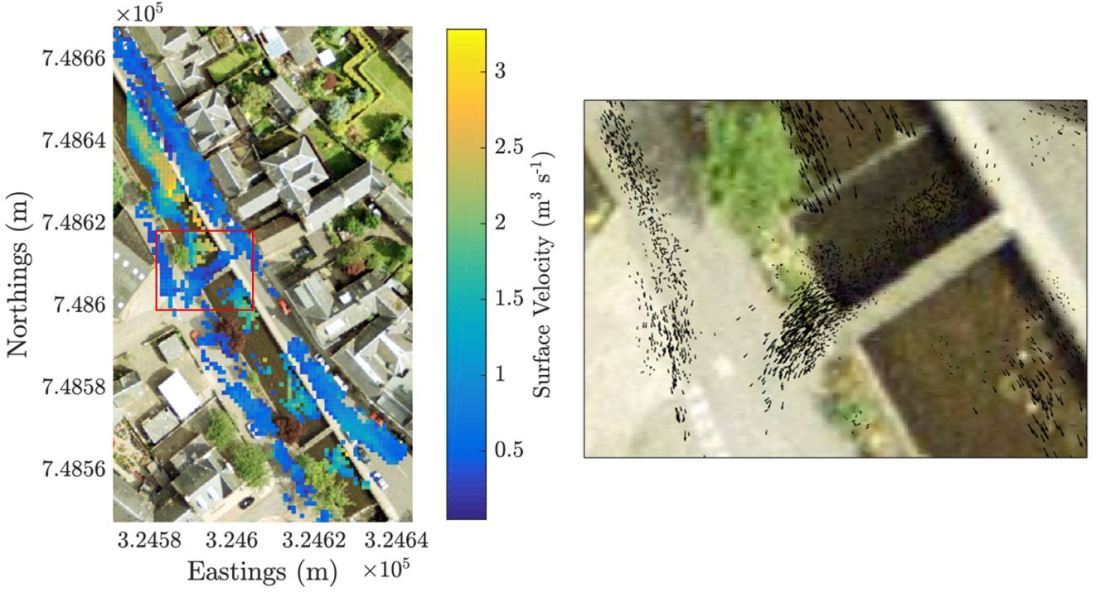
An example of the detailed velocity directions (right) that show the impact that the bridge has on the flow velocities.
